Technologies
INDUSTRY-LEADING TECHNOLOGIES
Complete your complex large-diameter pipe inspection hassle-free with SewerVUE’s industry-leading technologies.
Learn MoreWhen going through rehabilitation efforts, it is essential to have data engineers can rely on. SewerVUE Technology can provide multi-sensor data that allows for our clients and partners to make informed and cost effective decisions about their pipes.
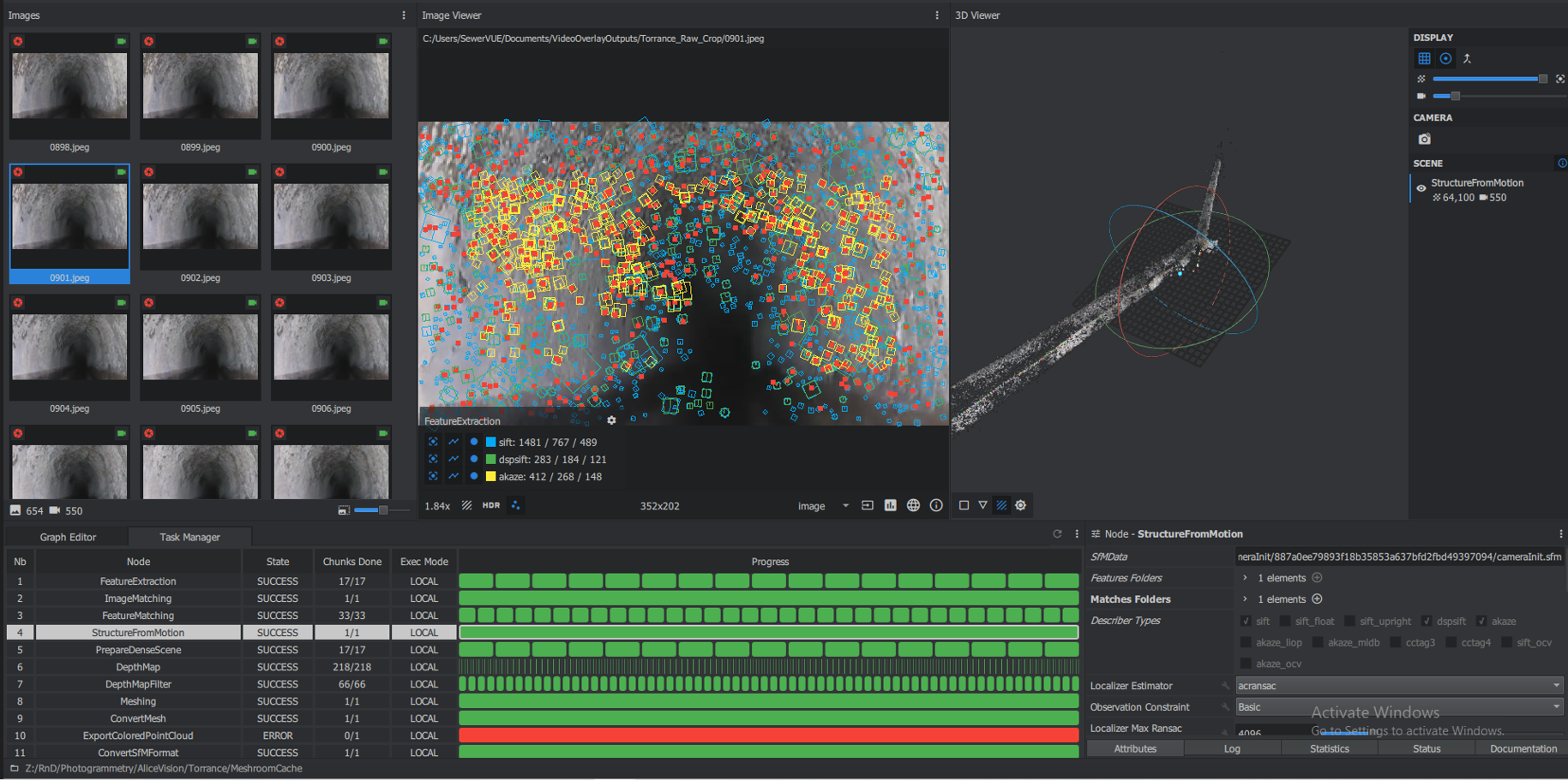
Photogrammetry
Photogrammetry uses multiple perspective video captured by SewerVUE’s multi-sensor technology to recreate a digital twin of the inspected pipeline.
Pipe-Penetrating Radar
Pipe penetrating radar is SewerVUE Technology’s proprietary pipeline condition assessment technology. PPR is the in-pipe application of ground penetrating radar. GPR antennas are taken inside the pipe and used to scan the inner wall. With this method, SewerVUE can gather a wealth of quantitative, accurate information about the condition of the pipe. PPR surveys can see remaining wall thickness, rebar cover, delamination, and even detect the presence of voids developing outside the pipe
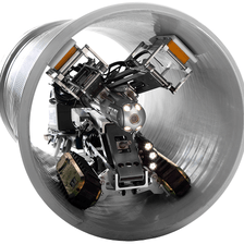
PPR surveys can be conducted with man-entry operations where it is safe to do so, or with remotely-operated vehicles where it is not. SewerVUE uses two different ROVs for PPR surveys: the 4th-generation Surveyor, and the Asbestos Cement Pipe Scanner.
PPR | How Does it Work?
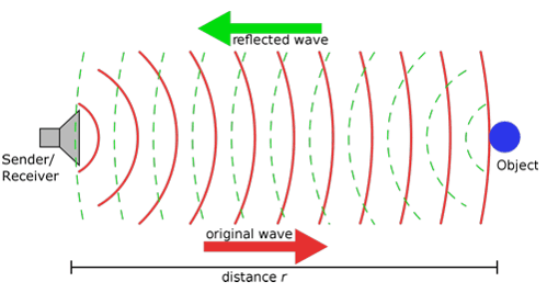
PPR is a pipeline inspection technology that uses GPR to investigate the subsurface of the Earth by emitting electromagnetic (EM) waves and measuring the reflected signals. PPR is the adaptation of this technology for use from inside pipes.
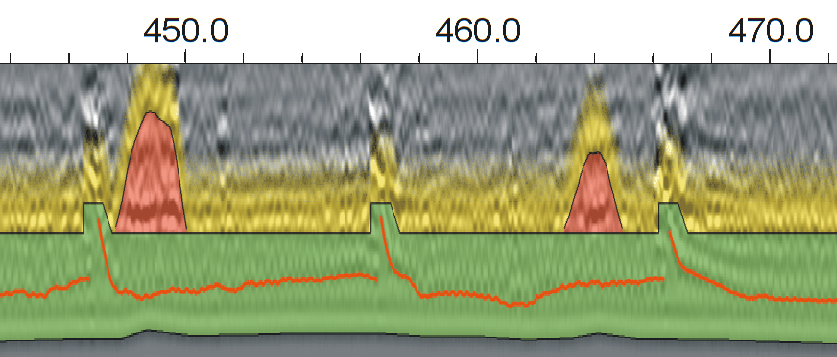
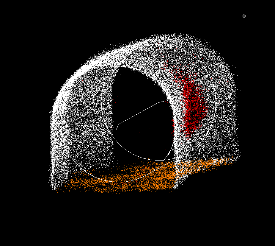
Example PPR data, with interpretation superimposed. Green is the pipe wall, the red line represents rebar, and the red areas represent voids. EM waves have two important properties: they travel at different speeds through different materials, and the amplitude of their reflections is greater depending on the contrast between two materials. By measuring the two-way travel time and the amplitude of the reflected EM waves, a detailed image of the subsurface can be built. By repeating this process continuously along a survey line, a profile of the line is created. This can be done at multiple clock positions to provide a detailed report on the pipe’s current condition, as well as the presence or absence of voids outside the pipe wall.
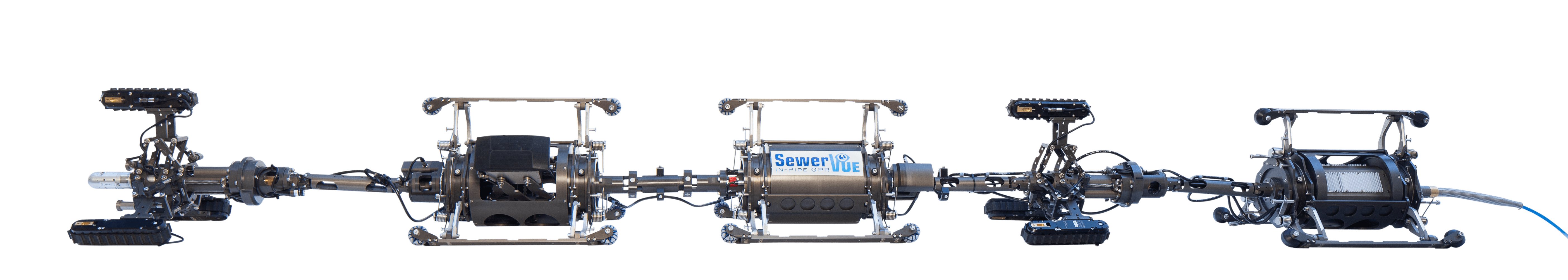
The most commonly deployed ROV, the Surveyor, carries two PPR antennas. These can be adjusted to collect data from any two clock positions between 9 and 3 o’clock. In ```a typical survey, lines of data are collected from two clock positions as the robot moves in one direction, and two different positions as the robot returns to the deployment point.
This results in four lines of PPR data with just one deployment. The PPR antennae on the Surveyor transmit at 1.6 GHz or 2.3 GHz frequencies, which results in signal penetration depth of up to 920 mm. Combined with LiDAR and CCTV information collected simultaneously, PPR surveys can provide actionable information with a safe, cost-effective method. Contact us to find out how PPR can meet your needs.
Multi Sensor Technologies
SewerVUE Technology is uniquely equipped with the latest msi technologies to tackle a wide variety of condition assessment projects. Our versatile multi-sensor inspection (MSI) system can collect quantitative data from non-ferrous pipes of all shapes and sizes. Using a combination of LiDAR, sonar, CCTV, and SewerVUE proprietary pipe penetrating radar technology, SewerVUE is equipped with all the tools to get the job done
MSI | SONAR
Sonar is the use of sound propagation to create an image of the pipe’s inner surface below the flow line. SewerVUE’s sonar technology details the pipe's profile and measures sediment volume, all with sub-centimetre accuracy. A sonar pipe inspection in conjunction with LiDAR imaging enables SewerVUE to generate a 360-degree image of the pipe that includes quantitative determination of ovality, wall loss, sediment volume, and depth, even through tight bends.
MSI | LiDAR
Light and Radar, or LiDAR, is a multi-sensor (MSI) inspection method among pipes. LiDAR surveys are done by projecting a laser, and measuring the time it takes for it to reach a target and reflect back to the sensor. A LiDAR survey collects continuous 2-D cross sections of the pipe wall. By compiling these cross sections, a high-resolution 3-D model is created. SewerVUE offers advanced MSI inspections utilizing LiDAR imaging to deliver sub-centimetre accuracy. LiDAR is used to measure the pipe above the flow line. It collects highly detailed information about ovality, deformations, offset joints, and lateral size
MSI | CCTV
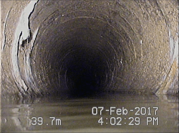
CCTV is the most well-known condition assessment method, and is included in all of our surveying operations. A CCTV feed is used to navigate our ROVs past unexpected obstacles in pipes, but is also useful in identifying any visual anomalies discovered by the other, more advanced inspection techniques
MSI | 4-in-1 Viewer
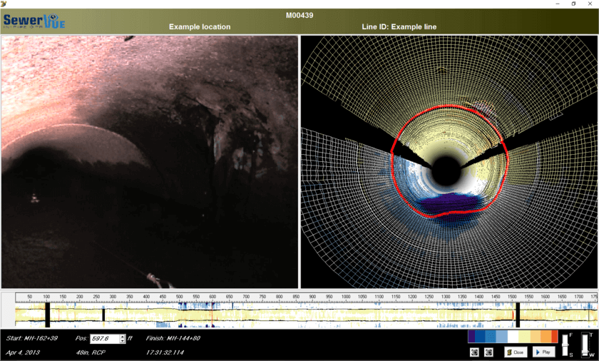
With so much information available through SewerVUE’s MSI technologies, organizing the data in a useful manner is crucial
SewerVUE uses advanced proprietary software to visualize the data. PPR, LiDAR, sonar, and CCTV results are delivered in a comprehensive post-inspection report. The information is also viewable in SewerVUE’s 4-in-1 software. The 4-in-1 Viewer allows for all of the information collected from a survey to be viewed simultaneously, with an intuitive layout.